


Most problems in an automated snow depth record begin before the first flake falls. A reference distance taken over uncut grass, a mounting arm that shifts under its first heavy ice load, or a logger clock that was never synchronized can each create a season of data that looks reasonable while quietly introducing error.
For hydrological services, avalanche programs, transportation agencies and research networks, the weeks before snowfall are the best opportunity to catch those problems. Newer sensor technology can improve reliability, but even the most capable instrument still depends on a well-prepared site, a stable installation, and a clean data path.
Establishing the baseline
Distance-based snow depth sensors calculate depth by comparing a calibrated reference distance with the current distance to the snow surface. That reference becomes the foundation of the record.
Vegetation is a common source of early-season error. Grass and low brush create an uneven surface, then compress beneath the first accumulation. Early readings can reflect vegetation settling as much as actual snow accumulation. Clearing and leveling the measurement area helps remove that uncertainty.
If snow is already on the ground at installation, the existing depth can be measured manually and entered during setup. That starting point should also be documented in the station metadata.
Matching height to the site
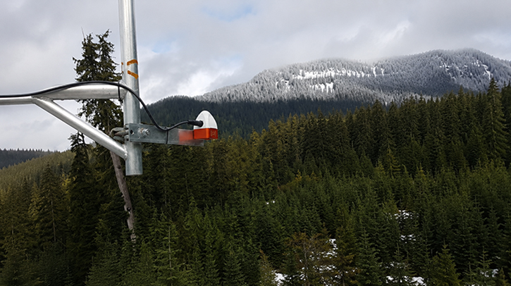
Mounting height affects both the maximum depth a sensor can measure and the size of the area it samples. SNOdar, a snow depth sensor from R M Young Company relaunched in 2026, uses a lidar-based module to measure a cone approximately 25cm across at 3m, increasing to about 75cm at 9m.
Published accuracy is ±1 cm at ranges up to 2m, ±2 cm to 4m, and ±4cm to 8m. That favors using the lowest mounting height that still leaves sufficient clearance for the deepest expected snowpack.
A sensor positioned over a drift zone or wind-scoured patch may measure that location accurately while poorly representing the surrounding terrain. The goal is not simply finding a clear spot beneath the tower, but selecting a measurement area that reflects the site as a whole.
Maintaining sensor alignment
If a sensor tilts after calibration, the measurement path becomes longer and can make snow depth appear lower than it actually is. Towers settle as soils freeze, clamps loosen through freeze-thaw cycles, and rime or heavy snow can add leverage to mounting arms.
SNOdar records pitch and roll at calibration and flags changes greater than 5°, with a second threshold at 20°. Those diagnostics help operators distinguish changes in the snowpack from changes in the installation.
Where a vertical drop is not practical, the sensor can be mounted at up to 30° from vertical, although the maximum measurement range is reduced. Its 2026 hardware update also introduced a redesigned mounting clamp intended to improve thermal isolation from the supporting structure.
Following the data path
A pre-season inspection should not end at the sensor. The data path should be checked from measurement through logging, telemetry and final storage.
Daily snowfall calculations depend on reset times, while seasonal accumulation may depend on a reset date. If the sensor, data logger, and telemetry system are not synchronized, accumulation can shift between reporting periods even when the distance measurement itself is correct.
Diagnostic channels can reveal developing problems before the depth record is affected. Supply voltage, internal temperature and heater status can expose a weakening power system or heater fault. Winter power budgets should also account for shorter daylight hours and heater demand. SNOdar has a published average power consumption of 0.5W, and its internal non-volatile logger can retain a full season of data if cellular or satellite communications are interrupted.
Validating the first season
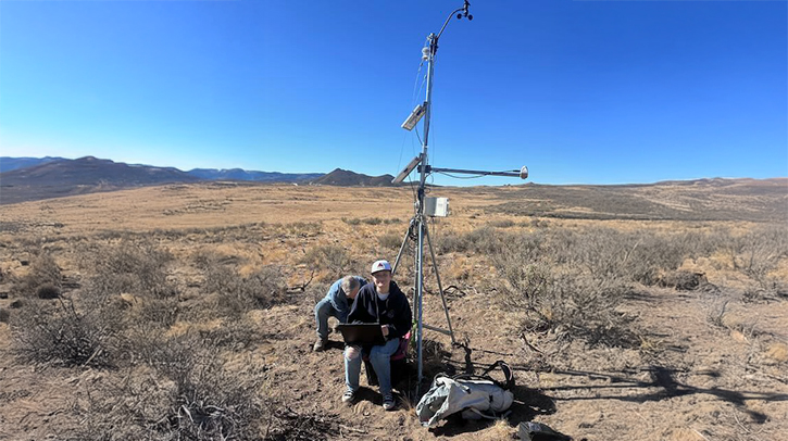
Even a carefully installed station benefits from field validation. Periodic manual observations at a nearby snow stake or stormboard can confirm that the baseline remains correct and that the site continues to represent the surrounding snowpack.
Storm totals create an additional challenge because snow can settle while precipitation is still falling. Some networks use one sensor over the natural snowpack and another over a stormboard cleared on a fixed schedule, providing a clearer view of both total depth and new snowfall.
Sensor height, mounting angle, baseline date and later adjustments should also be documented. Good metadata may seem routine during installation, but it is often the only way to make sense of a record reviewed years later.
Measuring through active snowfall
Modern lidar-based sensors, like SNOdar, improve measurements during active snowfall by evaluating multiple returns rather than relying on a single return. The Northwest Avalanche Center, which operates stations across the Cascades, has reported strong storm-condition performance from SNOdar within its network.
Even the best sensor cannot compensate for a poor baseline, a shifting mount or a broken data path. Those problems are best solved before the first storm arrives.

Samantha Peterson is the marketing manager for R M Young Company, bringing more than 15 years of experience in marketing and communications, a bachelor’s degree in advertising and writing, extensive knowledge of meteorological instrumentation and environmental measurement, and a passion for storytelling.