According to OTT HydroMet, a specialist in meteorological instrumentation and monitoring, one of the most important challenges when designing monitoring facilities in remote locations is resilience.
For example, remote tide gauge systems operate in extremely harsh environments and require robust communications systems that almost never fail and are capable of storing large amounts of data locally as an extra protection for data.
With these considerations, the company said, scientists from the National Oceanography Centre (NOC) are upgrading the South Atlantic Tide Gauge Network (SATGN) to include OTT HydroMet’s latest low-power dataloggers with built-in satellite telemetry capability – the SatLink3.
The SATGN is maintained and operated by the National Oceanography Centre, the UK center of excellence for sea level monitoring, coastal flood forecasting and sea level analysis. It is the focus for marine water level research in the UK and for the provision of advice for policymakers, planners and coastal engineers.
The SATGN measures sea levels in some of the most remote places on Earth. Monitoring sites include Antarctic locations such as Rothera and Vernadsky; located around 1,400km below the southern tip of Argentina. Prior to the installation of this network there was a lack of information on sea level variations in the Southern Atlantic and a bias in tide gauge records toward the more densely populated northern hemisphere. Over the last 30 years data from the SATGN has improved estimates of global sea level change, such as those reported by the Intergovernmental Panel on Climate Change.
The NOC in Liverpool, UK, operates and maintains the SATGN, providing near real-time sea level data for operational purposes and scientific research. This has helped to provide a long-term sea level record that is used by UK scientists and the wider scientific community to monitor the Antarctic Circumpolar Current (ACC) variability.
The data is also being used to help in the ‘ground truthing’ of satellite altimetry as well as the evaluation of climate variability on various timescales including longer term changes. In addition, the data is being used by local communities to provide essential information for both government and port authorities.
Monitoring/telemetry system upgrade
In recent years, the SATGN has undergone a refurbishment program to reduce running costs and to safeguard local populations and infrastructure by providing tsunami-monitoring capability and improving resilience. The new gauges couple global navigation satellite system (GNSS) land level-monitoring technology with tsunami-capable radar and pressure sensors, transmitting data in near real time by satellite-based communications systems to operational monitoring centers.
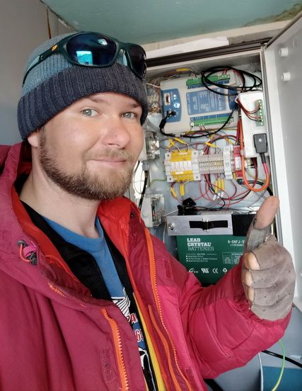
![]() As part of this ongoing program, the tide gauges’ main datalogger and transmitter have been upgraded to incorporate OTT HydroMet’s new Sutron SatLink3. The first site to receive this upgrade was the Vernadsky station in Antarctica, which is now operated by Ukrainian scientists, and it is soon to be followed by the tide gauge at King Edward Point, on the South Georgia Islands.
As part of this ongoing program, the tide gauges’ main datalogger and transmitter have been upgraded to incorporate OTT HydroMet’s new Sutron SatLink3. The first site to receive this upgrade was the Vernadsky station in Antarctica, which is now operated by Ukrainian scientists, and it is soon to be followed by the tide gauge at King Edward Point, on the South Georgia Islands.
The company noted that a further advantage of the upgrade is the SatLink3’s ability to communicate via wi-fi with wireless devices, including smartphones, tablets and computers. This means that local staff can connect wirelessly to the logger from a few meters away, a major advantage during inclement weather conditions.
Sensors
OTT HydroMet said the SatLink3 datalogger is capable of accepting readings from a wide variety of sensors, with two independent SDI-12 channels, five analog channels, one 4-20mA channel and two digital inputs. The Vernadsky station includes a barometric pressure sensor, a radar level sensor installed over a heated/insulated stilling well (keeping the inner core free of ice) and two OTT PLS pressure level sensors which provide accurate measurements of water depth.
The network uses the Geostationary Operational Environmental Satellite (GOES) to transmit data. GOES is operated by the USA’s National Oceanic and Atmospheric Administration’s (NOAA) National Environmental Satellite, Data, and Information Service (NESDIS). One-minute averaged data is transmitted every 15 minutes. The data is then made freely available on the IOC Sea Level Station Monitoring Facility website, www.ioc-sealevelmonitoring.org.
The logging upgrade should enhance the resilience of the SATGN. Jeff Pugh from the Marine Physics and Ocean Climate Group at the NOC commented, “The data from this network informs models that assist with projections relating to climate change, and others which provide advance warnings that can help protect life and property. Given the remote locations of the monitoring sites, it is vitally important, therefore, that the instruments are extremely reliable, operating on low power, with very little requirement for service or spares. By transmitting almost live data via satellite, these monitoring systems enable the models to deliver timely warnings; advance notice of tsunami, for example, can be of critical importance.”
Satellite telemetry is becoming increasingly popular in many other parts of the world. “Some government and non-commercial organizations are able to utilize a variety of satellites free of charge,” explained OTT’s Nigel Grimsley. “However, the cost of transmitting data via satellite has reduced considerably recently, and now rivals the cost of cellular communications.”