Meteorological Technology International
  • News
    • A-E
      • Agriculture
      • Automated Weather Stations
      • Aviation
      • Climate Measurement
      • Data
      • Developing Countries
      • Digital Applications
      • Early Warning Systems
      • Extreme Weather
    • G-P
      • Hydrology
      • Lidar
      • Lightning Detection
      • New Appointments
      • Nowcasting
      • Numerical Weather Prediction
      • Polar Weather
    • R-S
      • Radar
      • Rainfall
      • Remote Sensing
      • Renewable Energy
      • Satellites
      • Solar
      • Space Weather
      • Supercomputers
    • T-Z
      • Training
      • Transport
      • Weather Instruments
      • Wind
      • World Meteorological Organization
      • Meteorological Technology World Expo
  • Features
  • Online Magazines
    • April 2025
    • January 2025
    • September 2024
    • April 2024
    • Archive Issues
    • Subscribe Free!
  • Opinion
  • Videos
  • Supplier Spotlight
  • Expo
LinkedIn Twitter Facebook
  • Sign-up for Free Weekly E-Newsletter
  • Meet the Editors
  • Contact Us
  • Media Pack
LinkedIn Facebook
Subscribe
Meteorological Technology International
  • News
      • Agriculture
      • Automated Weather Stations
      • Aviation
      • Climate Measurement
      • Data
      • Developing Countries
      • Digital Applications
      • Early Warning Systems
      • Extreme Weather
      • Hydrology
      • Lidar
      • Lightning Detection
      • New Appointments
      • Nowcasting
      • Numerical Weather Prediction
      • Polar Weather
      • Radar
      • Rainfall
      • Remote Sensing
      • Renewable Energy
      • Satellites
      • Solar
      • Space Weather
      • Supercomputers
      • Training
      • Transport
      • Weather Instruments
      • Wind
      • World Meteorological Organization
      • Meteorological Technology World Expo
  • Features
  • Online Magazines
    1. April 2025
    2. January 2025
    3. September 2024
    4. April 2024
    5. January 2024
    6. September 2023
    7. April 2023
    8. Archive Issues
    9. Subscribe Free!
    Featured
    April 15, 2025

    In this Issue – April 2025

    By Web TeamApril 15, 2025
    Recent

    In this Issue – April 2025

    April 15, 2025

    In this Issue – January 2025

    December 13, 2024

    In this Issue – September 2024

    August 8, 2024
  • Opinion
  • Videos
  • Supplier Spotlight
  • Expo
Facebook LinkedIn
Subscribe
Meteorological Technology International
Hydrology

NASA uses high-resolution cameras to locate surface-accessible ice on Mars

Elizabeth BakerBy Elizabeth BakerNovember 3, 20234 Mins Read
Share LinkedIn Facebook Twitter Email
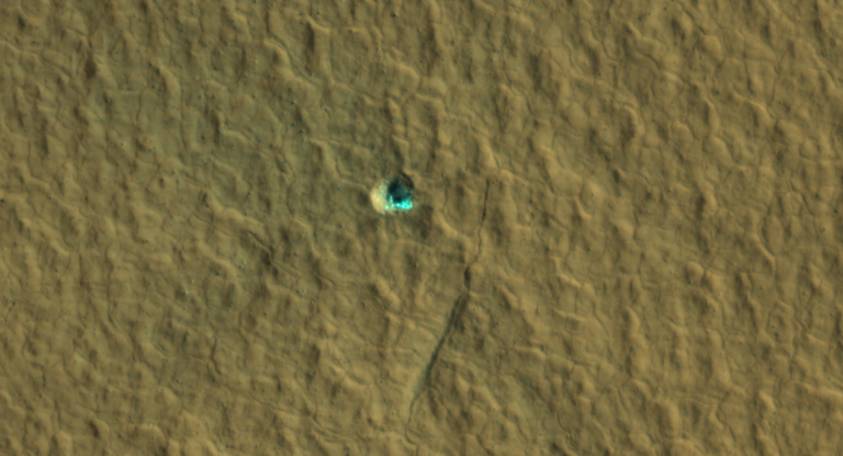
The ice-exposing impact crater at the center of this image is an example of what scientists look for when mapping places where future astronauts should land on Mars. It’s one of several such impacts incorporated into the latest version of a series of NASA-funded maps of subsurface water ice on the Red Planet. Credit: NASA/JPL-Caltech/University of Arizona
Share
LinkedIn Facebook Twitter Email

Led by the Planetary Science Institute in Tucson, Arizona, and managed by NASA’s Jet Propulsion Laboratory in Southern California, the Subsurface Water Ice Mapping (SWIM) project has released its fourth set of maps – the most detailed since the project began in 2017.

SWIM pulls together data from several NASA missions, including the Mars Reconnaissance Orbiter (MRO), 2001 Mars Odyssey and the now-inactive Mars Global Surveyor. Using a mix of data sets, scientists have identified the likeliest places to find Martian ice that could be accessed from the surface by future missions.

Previous iterations of the map relied on lower-resolution imagers, radar, thermal mappers and spectrometers, all of which can hint at buried ice but can’t outright confirm its presence or quantity. For this latest SWIM map, scientists relied on two higher-resolution cameras on board MRO. Context camera data was used to further refine the northern hemisphere maps and, for the first time, high-resolution imaging science experiment (HiRISE) data was incorporated to provide the most detailed perspective of the ice’s boundary line as close to the equator as possible.

Scientists routinely use HiRISE to study fresh impact craters caused by meteoroids that may have excavated chunks of ice. Most of these craters are no more than 33ft (10m) in diameter, although in 2022 HiRISE captured a 492ft-wide (150m-wide) impact crater that revealed a motherlode of ice that had been hiding beneath the surface.

According to the organization, buried ice will be a vital resource for the first people to set foot on Mars, serving as drinking water and a key ingredient for rocket fuel. However, it would also be a major scientific target – astronauts or robots could one day drill ice cores much as scientists do on Earth, uncovering the climate history of Mars and exploring potential habitats (past or present) for microbial life.

The need to look for subsurface ice arises because liquid water isn’t stable on the Martian surface. The atmosphere is so thin that water immediately vaporizes. There’s plenty of ice at the Martian poles – mostly made of water, although carbon dioxide, or dry ice, can be found as well – but those regions are too cold for astronauts (or robots) to survive for long.

Instruments on these spacecraft have detected what looks like masses of subsurface frozen water along Mars’s mid-latitudes. The northern mid-latitudes are reportedly appealing because they have a thicker atmosphere than most other regions on the planet, making it easier to slow a descending spacecraft. The ideal astronaut landing site would be a sweet spot at the southernmost edge of this region – far enough north for ice to be present but close enough to the equator to ensure the warmest possible temperatures for astronauts in an icy region.

“If you send humans to Mars, you want to get them as close to the equator as you can,” said Sydney Do, JPL’s SWIM project manager. “The less energy you have to expend on keeping astronauts and their supporting equipment warm, the more you have for other things they’ll need.”
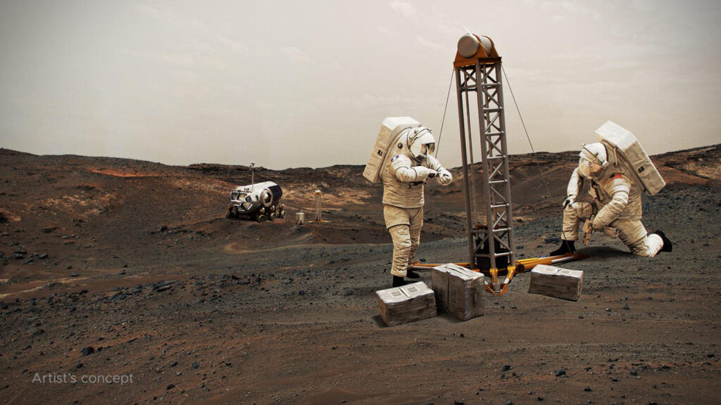
In this artist’s concept, NASA astronauts drill into the Martian subsurface. The agency has created new maps that show where ice is most likely to be easily accessible to future astronauts.
Pic NASA

“These ice-revealing impacts provide a valuable form of ground truth in that they show us locations where the presence of ground ice is unequivocal,” said Gareth Morgan, SWIM’s co-lead at the Planetary Science Institute. “We can then use these locations to test that our mapping methods are sound.”

In addition to ice-exposing impacts, the new map includes sightings by HiRISE of so-called “polygon terrain”, where the seasonal expansion and contraction of subsurface ice causes the ground to form polygonal cracks. Seeing these polygons extending around fresh, ice-filled impact craters is yet another indication that there’s more ice hidden beneath the surface at these locations.

There are other areas that scientists can use the map to study, as well. “The amount of water ice found in locations across the Martian mid-latitudes isn’t uniform; some regions seem to have more than others, and no one really knows why,” said Nathaniel Putzig, SWIM’s other co-lead at the Planetary Science Institute. “The newest SWIM map could lead to new hypotheses for why these variations happen.” He added that it could also help scientists tweak models of how the ancient Martian climate evolved, leaving larger amounts of ice deposited in some regions and lesser amounts in others.

SWIM’s scientists hope the project will serve as a foundation for a proposed Mars Ice Mapper mission – an orbiter that would be equipped with a powerful radar custom-designed to search for near-surface ice beyond where HiRISE has confirmed its presence.

To find out more about NASA’s latest developments, click here.

Previous ArticleVIDEO: Saildrone and NOAA release footage from Hurricane Tammy
Next Article NOAA conducts first ever collocated drone mission into a hurricane

Read Similar Stories

Hydrology

Integrated model improves flood risk assessment in China

May 15, 20253 Mins Read
Digital Applications

Tianjin University AI model turns street cameras into rainfall sensors

May 14, 20253 Mins Read
Climate Measurement

Omaha’s National Weather Service office resumes twice-daily balloon launches

May 7, 20252 Mins Read
Latest News

WMO and Beijing Climate Centre host climate monitoring and prediction forum in Qingdao

May 16, 2025

Integrated model improves flood risk assessment in China

May 15, 2025

EXCLUSIVE INTERVIEW: Ramla Qureshi, McMaster University’s Department of Civil Engineering

May 14, 2025

Receive breaking stories and features in your inbox each week, for free


Enter your email address:


Supplier Spotlights
  • BOSCHUNG MECATRONIC Ltd.
Latest Job Postings
  • Researcher/Engineer to support data-based weather forecasting (R2/RE2)

    • Barcelona
    • Barcelona Supercomputing Center - Centro Nacional de Supercomputación
    • Full Time
Getting in Touch
  • Contact Us / Advertise
  • Meet the Editors
  • Download Media Pack
  • Free Weekly E-Newsletter
Our Social Channels
  • Facebook
  • LinkedIn
© 2025 UKi Media & Events a division of UKIP Media & Events Ltd
  • Cookie Policy
  • Privacy Policy
  • Terms and Conditions
  • Notice and Takedown Policy

Type above and press Enter to search. Press Esc to cancel.

We use cookies on our website to give you the most relevant experience by remembering your preferences and repeat visits. By clicking “Accept”, you consent to the use of ALL the cookies.
Cookie settingsACCEPT
Manage consent

Privacy Overview

This website uses cookies to improve your experience while you navigate through the website. Out of these, the cookies that are categorized as necessary are stored on your browser as they are essential for the working of basic functionalities of the ...
Necessary
Always Enabled

Necessary cookies are absolutely essential for the website to function properly. These cookies ensure basic functionalities and security features of the website, anonymously.

CookieDurationDescription
cookielawinfo-checbox-analytics11 monthsThis cookie is set by GDPR Cookie Consent plugin. The cookie is used to store the user consent for the cookies in the category "Analytics".
cookielawinfo-checbox-functional11 monthsThe cookie is set by GDPR cookie consent to record the user consent for the cookies in the category "Functional".
cookielawinfo-checbox-others11 monthsThis cookie is set by GDPR Cookie Consent plugin. The cookie is used to store the user consent for the cookies in the category "Other.
cookielawinfo-checkbox-necessary11 monthsThis cookie is set by GDPR Cookie Consent plugin. The cookies is used to store the user consent for the cookies in the category "Necessary".
cookielawinfo-checkbox-performance11 monthsThis cookie is set by GDPR Cookie Consent plugin. The cookie is used to store the user consent for the cookies in the category "Performance".
viewed_cookie_policy11 monthsThe cookie is set by the GDPR Cookie Consent plugin and is used to store whether or not user has consented to the use of cookies. It does not store any personal data.

Functional

Functional cookies help to perform certain functionalities like sharing the content of the website on social media platforms, collect feedbacks, and other third-party features.

Performance

Performance cookies are used to understand and analyze the key performance indexes of the website which helps in delivering a better user experience for the visitors.

Analytics

Analytical cookies are used to understand how visitors interact with the website. These cookies help provide information on metrics the number of visitors, bounce rate, traffic source, etc.

Advertisement

Advertisement cookies are used to provide visitors with relevant ads and marketing campaigns. These cookies track visitors across websites and collect information to provide customized ads.

Others

Other uncategorized cookies are those that are being analyzed and have not been classified into a category as yet.

SAVE & ACCEPT
Powered by