


Close Menu
Meteorological Technology International
  • News
    • A-E
      • Agriculture
      • Automated Weather Stations
      • Aviation
      • Climate Measurement
      • Data
      • Developing Countries
      • Digital Applications
      • Early Warning Systems
      • Extreme Weather
    • G-P
      • Hydrology
      • Lidar
      • Lightning Detection
      • New Appointments
      • Nowcasting
      • Numerical Weather Prediction
      • Polar Weather
    • R-S
      • Radar
      • Rainfall
      • Remote Sensing
      • Renewable Energy
      • Satellites
      • Solar
      • Space Weather
      • Supercomputers
    • T-Z
      • Training
      • Transport
      • Weather Instruments
      • Wind
      • World Meteorological Organization
      • Meteorological Technology World Expo
  • Features
  • Online Magazines
    • January 2026
    • April 2025
    • January 2025
    • September 2024
    • April 2024
    • Archive Issues
    • Subscribe Free!
  • Opinion
  • Videos
  • Supplier Spotlight
  • Expo
LinkedIn X (Twitter) Facebook
  • Sign-up for Free Weekly E-Newsletter
  • Meet the Editors
  • Contact Us
  • Media Pack
LinkedIn Facebook
Subscribe
Meteorological Technology International
  • News
      • Agriculture
      • Automated Weather Stations
      • Aviation
      • Climate Measurement
      • Data
      • Developing Countries
      • Digital Applications
      • Early Warning Systems
      • Extreme Weather
      • Hydrology
      • Lidar
      • Lightning Detection
      • New Appointments
      • Nowcasting
      • Numerical Weather Prediction
      • Polar Weather
      • Radar
      • Rainfall
      • Remote Sensing
      • Renewable Energy
      • Satellites
      • Solar
      • Space Weather
      • Supercomputers
      • Training
      • Transport
      • Weather Instruments
      • Wind
      • World Meteorological Organization
      • Meteorological Technology World Expo
  • Features
  • Online Magazines
    1. April 2026
    2. January 2026
    3. September 2025
    4. April 2025
    5. January 2025
    6. September 2024
    7. April 2024
    8. January 2024
    9. Archive Issues
    10. Subscribe Free!
    Featured
    May 5, 2026

    In this Issue – April 2026

    By Web TeamMay 5, 2026
    Recent

    In this Issue – April 2026

    May 5, 2026

    In this Issue – January 2026

    November 27, 2025

    In this Issue – September 2025

    August 11, 2025
  • Opinion
  • Videos
  • Supplier Spotlight
  • Expo
Facebook LinkedIn
Subscribe
Meteorological Technology International
Early Warning Systems

NOC develops wave overtopping system to improve coastal hazard forecasts

Dan SymondsBy Dan SymondsMarch 7, 20232 Mins Read
Share LinkedIn Facebook Twitter Email
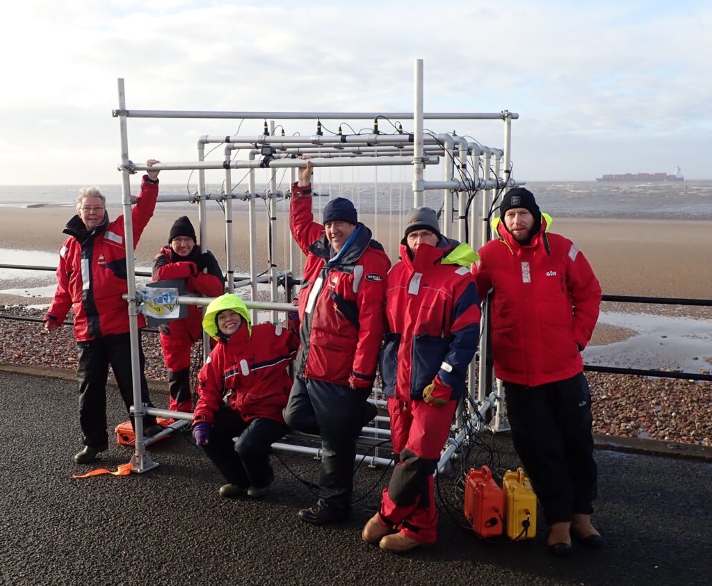
The NOC team with the WireWall coastal wave overtopping system - credit: NOC
Share
LinkedIn Facebook Twitter Email

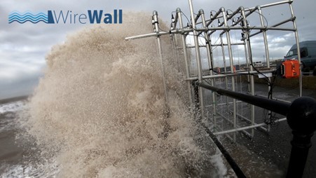
The UK’s National Oceanography Centre (NOC) has developed a new coastal wave overtopping system called WireWall which can measure the speed and volume of overtopping water on a wave-by-wave basis.

Coastal overtopping can cause flooding and pose a hazard to people, property and infrastructure so the ability to measure overtopping in the field will help reduce uncertainty in forecasts and improve hazard warning systems.

Traditionally, field data is obtained using large collection tanks that only obtain data on the total volume of water that has overtopped during a storm or high tide event. In addition, tanks can only be deployed on certain structures, such as the top of a coastal defense barrier, whereas WireWall has been designed so that it can be deployed on almost any structure.

WireWall overtopping measurements could be used to improve industry-standard overtopping prediction tools and hence improve flood and hazard forecasts. Field measurements of overtopping will also enable the study of wind and wave conditions that cause overtopping, thereby improving numerical models.

The WireWall project was funded by the Natural Environment Research Council (NERC) program ‘Innovative Monitoring Approaches’. A follow-on project called ‘Coastal REsistance: Alerts and Monitoring Technologies’ (CreamT) is now underway, funded by NERC’s Digital Environment program.

For more on coastal hazard forecasts, please click here.
Previous ArticleWMO Executive Council endorses plan for global greenhouse gas monitoring system
Next Article StormGeo expands its ownership in Climatempo

Read Similar Stories

Climate Measurement

Sonardyne provides navigation support to BAS GIANT climate mission studying Greenland’s glaciers

July 16, 20263 Mins Read
Climate Measurement

Highest June sea surface temperatures recorded as El Niño develops, Copernicus confirms

July 1, 20262 Mins Read
Data

ICPAC delivers early warnings 90% faster thanks to data center improvements

June 24, 20263 Mins Read
Latest News

Machine learning opens new possibilities for global atmospheric reanalysis

July 22, 2026

North Sea marine heatwave intensified impacts of Storm Babet by 9-20%

July 21, 2026

FEATURE: UAH study tracks post-wildfire weather shifts

July 21, 2026

Receive breaking stories and features in your inbox each week, for free


Enter your email address:


Supplier Spotlights
  • AIRMAR Technology Corporation
Getting in Touch
  • Contact Us / Advertise
  • Meet the Editors
  • Media Pack
  • Free Weekly E-Newsletter
Our Social Channels
  • Facebook
  • LinkedIn
© 2026 UKi Media & Events a division of UKIP Media & Events Ltd
  • Cookie Policy
  • Privacy Policy
  • Terms and Conditions
  • Notice and Takedown Policy

Type above and press Enter to search. Press Esc to cancel.