Following the launch of the world’s most advanced weather radar in Oklahoma, Meteorological Technology International looks at how radar technology has improved over the years and finds out what innovations hold immense promise for the future.
Radar technology has been used for decades to support weather monitoring and forecasting, and over the years its capabilities have gone from strength to strength. Even so, the technology has not yet reached its full potential, with researchers continuing to look at new ways to expand its capabilities, and meteorologists are excited to see what the future has in store.
“Any improvements to radar technology that would provide better detection of rainfall, wind and associated improvements with quantitative precipitation estimation (QPE) would provide immense benefits for prediction and provide warnings of severe weather,” comments Sinéad Duffy, radar meteorologist at Ireland’s Met Éireann.

The advance of radar tech
Historically, radar design has been based on reflector or dish antennas that move mechanically to scan the atmosphere. In the 2000s came the development of dual polarization, which enables hydrometeor classification. The move from magnetron-based transmitter to solid-state transmitter technology (SSTX) is another important change, notes Duffy, who believes it will improve system reliability, reduce lifecycle costs and enable the development of new measurement and signal processing methods.

“SSTX is currently under test in European national meteorological services, where nearly all operational weather radar networks currently use magnetron transmitters,” says Duffy. “We’re keeping up to date with this changing area and are interested to see progress in the challenges with SSTX weather radar systems compared with those that are magnetron-based. One of these is the protection against radio local area network (RLAN) interference in the 5GHz frequency band.
“RLAN devices may not be so easily able to detect the weather radar signal due to the different pulse characteristics of SSTX weather radar systems. RLAN interference to weather radar operations is not an insubstantial challenge, and it requires significant human resources in national meteorological services to monitor, liaise with national radio authorities and participate in radio frequency management,” Duffy adds.

“We have plans to research hail detection using radar data and possibly develop short-timescale hail forecasts.”
Sinéad Duffy, Met Éireann
Praise be to Horus
Radar experts such as David Schvartzman, assistant professor at the University of Oklahoma’s School of Meteorology and affiliated with the Advanced Radar Research Center (ARRC), believe we’ve reached the limit of what can be achieved with reflector/dish antenna technology, noting that there are some severe convective storms that evolve much faster than these dishes can observe. “We normally get volume updates on the order of five minutes or so with dish antenna radar, but we now need technology that can scan much faster,” Schvartzman explains.
Researching new possibilities, Robert Palmer, professor in meteorology and the ARRC’s executive director, and his team came across phased-array radar technology, which had been initially developed for military applications in the 1970s. This uses an arrangement of thousands of antenna elements, which can be excited individually, enabling users to steer the scanning beam in different directions electronically.

From this concept, the ARRC team, led by Palmer, developed what they call the world’s first all-digital polarimetric phased-array weather radar, which makes use of dual-polarization and digital phased-array technologies to provide broad scans of the skies and atmosphere every 15-30 seconds. “Meteorologists will see images that look like watching an actual movie of the storm,” Schvartzman enthuses.
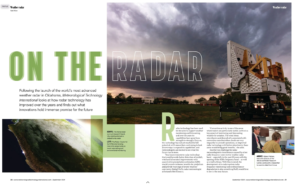
Named Horus after the Egyptian sky god with an ‘all-seeing eye’, the mobile unit consists of up to 1,600 antenna elements on a flat array that rises 6m into the air, providing data updates of unprecedented quality and temporal resolution. It was developed with support from the US National Oceanic and Atmospheric Administration (NOAA) National Severe Storms Laboratory (NSSL) to evaluate digital phased-array technologies for polarimetric weather observations. “The radar can operate like a digital camera, transmitting a wide beam of energy that illuminates a large sector, rather than using a narrow beam,” says Schvartzman. “It can take a picture of a whole region in one instant, as if hundreds of flashlight beams were illuminating an area at the same time.
“It also provides full vertical continuity of data, without leaving elevation gaps – you could sample every 0.2° if you wanted, very densely sampling the whole volume of precipitation,” Schvartzman adds.
The world’s most advanced weather radar
“It’s the obvious next-step technology for meteorological observation,” Schvartzman continues. “It enables much more rapid, flexible and adaptive scanning than dish radars so we can do very advanced scanning strategies. It also reduces the issue of wear and tear that you’d have with a mechanical dish radar,” he adds.
According to Schvartzman, this technology is of particular interest to the ARRC’s home state, which lies in Tornado Alley. These storms can change very quickly, and Horus’s ability to steer electronically allows it to scan a storm in a variety of ways with a simple computer command.
With the increase in frequency and severity of extreme weather events around the world, the impact of Horus will extend well beyond the US.
“Taking the raw data and turning it into something meaningful is where the science really happens.”
Jon Tarleton, Baron Weather
 Furthermore, because it can be reconfigured and updated as a ‘software-defined radar’, it can also be used for everything from detecting wildfires to measuring ground precipitation and monitoring ash during volcanic eruptions.
The Horus technology will likely help save lives by improving severe weather forecasting, and has already been able to capture previously undocumented events. “Lightning happens on a scale of maybe a few dozen milliseconds. Conventional radar are too slow to catch it, but Horus can see a lightning bolt coming down from the top of a cloud to the ground,” Schvartzman says. “It was an unprecedented observation that can advance our understanding of storm electrification processes. Then, during observations of tornadic storms this year, we were able to see different structures in a tornado for the first time; a fully continuous funnel that was tilted in a certain way.”

Are you ready for RaCERS?
Oklahoma is far from the only university researching advanced radar technology. In the UK, the University of Birmingham has just wrapped up its Radar Cluster for Earth Remote Sensing (RaCERS) feasibility study. The RaCERS project aims to deliver swarms of cooperating microsatellites that fly in tight formation to provide an accurate profile of Earth’s surface.
Flying in constellation, the microsatellites will use altimetry, scatterometry and synthetic aperture radar (SAR) to achieve enhanced image resolution that can help, among other things, with environmental monitoring and the forecasting of natural hazards.
“We aim to develop a cost-effective system that’s able to conduct multiple missions with multiple objectives,” says Marco Martorella, chair of radio frequency and space sensing in the university’s Department of Electronic, Electrical and Systems Engineering. “We’re looking at using bistatic configurations, where you have transmitters and receivers in different positions in space, to measure a number of parameters and obtain a more detailed image.”
According to Martorella, radar has strong benefits over visual light wavelengths for these types of measurements, as it can sense during day and night and – as it isn’t interrupted by cloud cover – ensures the delivery of a continuous feed of data. “Spaceborne radar is central to Earth environmental monitoring and forecasting. Usually weather radar are large, costly installations and so they’re not as numerous as meteorologists would like them to be. This means there are lots of gaps in terms of coverage,” he says.

“Spaceborne radar is central to Earth environmental monitoring and forecasting.”
Marco Martorella, University of Birmingham
Martorella was recently approached by a meteorologist asking whether the RaCERS concept could be used to measure atmospheric parameters, and he believes that it can. “In a bistatic configuration we could potentially use the channel between the transmitter and receiver as a way of measuring atmospheric parameters as the system orbits. I found research, with a low technological readiness level I must note, looking into this,” he says. “In this way, we could complement – and improve – the performance of existing systems that measure these parameters.”
Now complete, the feasibility study found that it is possible for RaCERS to reduce costs and produce the output performance requirements that had been set, and so Martorella and his colleagues are looking to source funding for the next stage of the project – full design.

Multiple benefits
As radar technology continues to evolve, it holds immense promise for improving weather monitoring and forecasting. Enhanced radar systems look set to provide a wide range of benefits to both meteorologists and the general public by mitigating the impacts of extreme weather, ultimately saving lives and enhancing our understanding of atmospheric phenomena. This article only just scratches the surface of the work currently underway in this field, and advancements continue unabated.
Time for an upgrade?
Many met services are looking to upgrade and expand their radar networks in order to improve monitoring capabilities. One example is Met Éireann, the Irish national meteorological service, which is in the process of upgrading its two existing C-band weather radar and has plans to add a further four to its network.
Coverage for the west of Ireland comes from its Shannon-based radar, which was upgraded to dual polarization in 2023, and the organization is now planning a similar upgrade for its east-focused radar in Dublin.
The key drivers behind this weather radar network upgrade project are improving the detection of precipitation and wind, quantitative precipitation estimation (QPE) and weather network coverage for numerical weather prediction (NWP) purposes, says Met Éireann’s Sinéad Duffy.
“We’ve already made use of dual-polarization attenuation correction, and improved dual-polarization-based clutter detection, ensuring the data from the Shannon radar is of better quality,” she notes. “Use of dual polarization will provide an improved ability to identify areas of heavy rainfall and better estimation of total precipitation, leading to better flash flood detection. This will be further enhanced by comparison to data from our national rain gauge network.”
“Hydrometeor classification algorithms using dual-polarization radar measurements provide the ability to distinguish different precipitation types,” she continues. “We have plans to research hail detection using radar data and possibly develop short-timescale hail forecasts based on radar data, surface weather station data and other meteorological input. Hail can be a significant problem on roads and to greenhouses and solar panels, and it would be valuable to investigate any way that dualpolarization data from the Shannon radar can be used to better detect and possibly generate more accurate hail nowcasts.”
As well as improving monitoring capabilities, the installation of a further four radar will enable the service to provide contingency cover for times when a radar must go offline for maintenance or upgrading.
The organization has already evaluated numerous locations in the southeast, southwest, midwest and northwest of Ireland to ensure optimal coverage for each individual radar and as part of the overall network, as well as to minimize interference.
A multidisciplinary team of engineers, planners, ecologists and other professionals has now been engaged to assess the sites’ suitability from other nonmeteorological perspectives. After that process is complete, it will then begin progressing the development of the sites in each region.
Where the science happens
Another area set to advance is signal processing, as, “Taking the raw data and turning it into something meaningful is where the science really happens,” says Jon Tarleton, VP of integrated weather systems at Baron Weather. He notes that there’s still a lot of room to make improvements in this area, to get clean data that can be used in a variety of applications.
Vendors continually work on ways to improve the quality of the data their products produce, which in the case of Baron Weather includes using machine learning tools to eliminate issues around anomalous propagation, wi-fi interference and wind turbine clutter.
The company is also looking at new and innovative ways to combine data and produce tools and applications where all the relevant information is available and critical elements can be easily examined. “We’re looking to provide value-added products and services from the radar data, in order to reduce the burden on the meteorologist, enabling them to focus on what’s really important,” Tarleton concludes.
This article originally appeared in the September 2024 issue of Meteorological Technology International. To view the magazine in full, click here.