

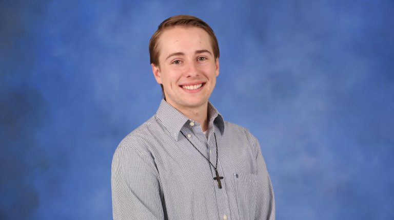
University of Alabama in Huntsville Earth System Science Center researcher Andrew Blackford, affiliated with NASA’s Marshall Space Flight Center, explains how wildfire burn scars can reshape local weather long after the flames are out
What first led you to investigate wildfire burn scars and their effect on local weather?
The idea began during discussions with some of the co-authors of the study at the 2023 American Meteorological Society Annual Meeting. We realized that while there has been extensive research on wildfire behavior and fire weather, much less attention has been given to what happens after the fire is over, especially the lingering effects resulting from altered land atmosphere exchanges. Those conversations motivated exploration of the topic as a NASA Visualization, Exploration, and Data Analysis (VEDA) data story, which ultimately grew into my master’s thesis research at the University of Alabama in Huntsville’s (UAH) Department of Atmospheric and Earth Science (AES) under the direction of Dr Udaysankar Nair. This project grew from the synergy among the UAH AES department, UAH’s Earth System Science Center (ESSC) and NASA’s Marshall Space Flight Center (MSFC), whose complementary expertise and resources enabled a highly integrated research effort.
What mechanisms cause a burn scar to alter local temperature and wind patterns?
Wildfires dramatically alter the physical characteristics of the land surface. Vegetation that once cooled the surface through evapotranspiration is removed, canopy height and surface roughness are reduced, and the way incoming solar energy is partitioned changes. Instead of using as much energy for evaporation, more energy is converted into sensible heating of the surface and lower atmosphere.
Those changes create localized thermal gradients between burned and unburned areas. Similar to an urban heat island, those gradients modify pressure patterns and strengthen local circulations, particularly in complex terrain. In our study, we found these land-surface changes increased sensible heat flux, dried the lower atmosphere, altered local wind fields, and even had some influence on cloud development and precipitation. Because the physical processes are analogous to those associated with cities, we coined the term “burn scar heat island” to describe these post-fire land-atmosphere interactions.
How did satellite and remote sensing data help you track these changes over time?
Satellite observations were fundamental to every stage of this research. We combined multiple NASA satellite products – including MODIS-derived vegetation, albedo, and land-surface temperature datasets, Landsat-derived land cover information, GEDI vegetation height measurements and burn severity products – to quantify how the landscape evolved following the California Camp Fire. These observations then served as constraints for paired WRF simulations, allowing us to isolate the atmospheric response caused specifically by the burn scar.
The Office of Data Science and Informatics (ODSI) VEDA platform at NASA’s MSFC played an equally important role by providing a cloud-native environment where some of these datasets could be discovered, visualized, analyzed and communicated within a single workflow. Rather than spending significant effort acquiring and preprocessing large volumes of satellite data, we were able to focus on the science itself. After completing the research, VEDA also allowed us to communicate the findings through an interactive data story, helping to translate complex satellite observations into an accessible resource for researchers, decision-makers and the public.
What were the key changes you observed in temperature, humidity and wind around burn scars?
The burn scar consistently altered both the land surface and the atmosphere. Satellite observations showed daytime land-surface temperatures increasing by an average of about 2.5K from the three-year period following the Camp Fire (2019-2022), with localized increases exceeding 6K, while vegetation cover declined substantially following the fire. Over the years following the Camp Fire, daytime land-surface temperatures continued an increasing trend, suggesting these effects persist well beyond the immediate recovery period.
Our numerical simulations showed that these surface changes translated into measurable atmospheric impacts. The diurnal temperature range grew, surface dew points decreased as evapotranspiration was reduced, and local terrain-driven circulations were modified. We also found that these circulation changes influenced cloud formation and shifted localized rainfall patterns, demonstrating that burn scars can affect atmospheric processes from the surface through much of the boundary layer.
How long can these effects persist after a wildfire has been extinguished?
Using more than two decades of satellite observations, we found that the burn scar continued exhibiting statistically significant trends in land-surface temperature and vegetation recovery for several years after the fire. Daytime land-surface temperatures in particular continued an increasing trend throughout the entire four-year period we analyzed following the Camp Fire. These impacts ultimately diminish as vegetation recovers and the land surface gradually returns toward its pre-fire state.
How could this research be used by weather forecasters or emergency planners?
Burn scars can modify local temperatures, humidity, winds, and even clouds and precipitation, all of which influence weather forecasting and hazard planning in fire-prone regions. These findings can help improve representation of post-fire landscapes within numerical weather prediction models while also informing emergency managers about secondary hazards during recovery, such as altered fire weather conditions, flooding or changing local circulation patterns. More broadly, the work demonstrates how combining satellite observations with numerical modeling can improve our understanding of land-atmosphere feedbacks following major disasters.
What role did NASA’s VEDA platform play in shaping this study?
NASA ODSI’s VEDA platform was instrumental throughout this project because it supported nearly the entire scientific workflow from analysis to communication. Much of the research was conducted within VEDA’s cloud-based JupyterHub environment, where we were able to access and analyze NASA Earth observation datasets without the traditional challenges of downloading, storing and managing large volumes of geospatial data locally. Working in a cloud-native environment allowed us to focus our efforts on the science rather than the computational infrastructure.
Once the analysis was complete, VEDA also provided a platform to communicate the results through an interactive data story. Key analysis products from the study were surfaced in the data story, allowing readers to explore the satellite observations alongside the scientific narrative. The data story format combines interactive maps and other dataset visualizations alongside contextual explanations into a single experience, making this research on complex land-atmosphere interactions easily accessible and digestible to researchers, decision-makers and the broader public.
On a personal level, VEDA has also been an incredible opportunity for me as an early-career scientist. I first joined the project as a graduate research assistant while pursuing my master’s degree at UAH, where developing data stories became a major part of my work. Working alongside researchers from the AES department, the ESSC, and NASA’s MSFC allowed me to contribute to NASA-supported research while learning cloud-native geospatial analysis, scientific communication and collaborative software development. It ultimately helped shape both this study and the direction of my research career.
What will you be working on next in this field?
My ongoing PhD research continues to explore how changes at Earth’s surface influence atmospheric processes, with a particular emphasis on severe weather and natural hazards. My current work combines commercial satellite imagery provided through NASA’s Commercial Satellite Data Acquisition (CSDA) Program with Doppler radar observations and high-resolution numerical and terrain-aware analytical modeling to better understand tornado damage, near-surface wind fields, and the role that terrain and land cover play in shaping tornado impacts. Ultimately, the goal is to improve how satellite observations can be transformed into actionable information for both scientific research and disaster response.
Beyond my dissertation research, I continue to contribute to several NASA Earth science initiatives that focus on improving both the accessibility and the utility of Earth observation data. Through NASA’s VEDA project, I support the development of cloud-native applications and decision-support platforms such as the NASA Disasters PORTAL and the AIR4US Web Portal, helping transform complex Earth observation datasets into interactive tools that support a variety of personas. I’m also supporting NASA’s Commercial Satellite Data Acquisition (CSDA) Program informatics workflows that simplify the use of commercial Earth observation imagery. This includes building cloud-native processing pipelines, standardized metadata and mapping products for a discoverable SpatioTemporal Asset Catalog (STAC) that reduces the technical barriers to incorporating commercial satellite data into scientific research.
Is there anything else you would like to add?
Throughout my research, I’ve found myself continually coming back to one central question: how do changes at Earth’s surface influence the atmosphere? Whether that’s a wildfire burn scar, a tornado track or an urban environment, advances in Earth observation are giving us entirely new ways to explore those interactions. It’s been exciting to contribute to that effort through initiatives like NASA’s VEDA platform and the CSDA Program, which are helping bridge the gap between scientific research and actionable applications. I think we’re entering a period where cloud-native technologies, open science and next-generation satellite observations will fundamentally change how we study and respond to natural hazards.