

The first ever geostationary satellite to provide 3D profiles for temperature and humidity for Europe will launch today, in the latest phase of a multi-year project by EUMETSAT.
The Meteosat Third Generation Sounder (MTG-S1) will join the imager satellite, which launched in 2022, and is now the primary imaging satellite for Europe and providing data to European meteorological organizations.
The launch, organized by EUMETSAT, will put MTG-S1 into orbit focused on Europe and will provide data to enhance the next generation of weather forecasts. It’s the second satellite as part of a series of six which are intended to revolutionize and safeguard weather forecasting across Europe for the next 20 years.
MTG-S1 includes an infrared sounder, which will provide the first ever regular 3D profiles for temperature and humidity, providing more data for meteorologists and to be embedded in numerical weather predictions.
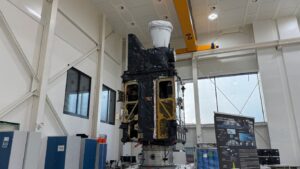
MTG-S1 in orbit
The Infrared Sounder scans Europe every 30 minutes, providing near-real time observations for meteorologists in a marked shift from existing sounder observations, which come from low-earth orbit satellites typically only revisiting Europe a few times a day. The space-to-ground profiles will enable more complex calculations and support understanding of the competing factors at play in the Earth’s atmosphere.
The enhanced detail and frequency of data is crucial to forecasters, according to Simon Keogh, head of space applications and nowcasting R&D at Met Office: “The infrared sounder represents a marked step-change in data availability for forecasters in Europe. The data will further enhance our nowcasting capabilities, which is the forecasting of impactful convective systems at short ranges.
“Coupled with the imaging satellite that is now providing data, the sounding satellite will allow meteorologists to make more detailed, timely and accurate assessments of the atmosphere prior to severe convective rainfall and thunderstorms, which can be responsible for impactful weather, including flash floods.”
MTG instruments
The satellite also hosts the Copernicus Sentinel-4 mission, by carrying an ultraviolet, visible and near-infrared spectrometer which will be used for long-term climate monitoring, and which captures data every hour to monitor air quality and pollution over Europe and North Africa.
Harshbir Sangha, director of missions and capabilities at the UK Space Agency, said, “The data from Sentinel 4 will be pivotal for the UK’s Earth observation sector, particularly users of the Copernicus Atmosphere Monitoring Service, by allowing rapid, hourly forecasting on air quality and pollution.
“We are proud to acknowledge the UK’s critical role in the instrument’s development, with essential characterization and calibration phases carried out at the RAL Space’s test facility, ensuring Sentinel‑4 meets the exacting standards necessary to support timely, policy-relevant air quality services.”
Phil Evans, director-general of EUMETSAT, stated, “MTG-S1 will provide entirely new types of data products that will support specialists across EUMETSAT member states to detect signs of atmospheric instability even before clouds begin to form. Combined with data from the MTG imaging satellites it will, for the first time, offer a space-based view of the full lifecycle of convective storms. This will provide tremendous support to national meteorological services in carrying out their vital work, helping to save lives, reduce disruption and strengthen resilience.
“The effects of the climate crisis are not distant threats: they are already being felt across Europe – through more frequent storms, longer heatwaves and shifting climate patterns. MTG-S1 will support more timely warnings, safer travel decisions, more effective emergency response and support informed action.
“My sincere thanks go to everyone who made MTG-S1 possible – our teams at EUMETSAT, our member states, the European Union, the European Space Agency, national meteorological services and all our industrial and academic partners. This successful launch is a testament to the strength of European cooperation. We now move to the next phases and preparing the satellite for full operations.”
The future of Europe’s satellite monitoring
Post launch, it will take around a year for the first data to be available from the satellite, with further quality assurance tests needed before the new data can be routinely used by meteorologists in Europe.
The next launch in this series, of a further imaging satellite, will be led by EUMETSAT and ESA and is expected in 2026.
Simon Brown, managing director of products and services for the Met Office, said, “Our vision is to be the most trusted for weather and climate intelligence and, once available, the more frequent and more detailed satellite data will be assimilated into calculations run on our new supercomputer, providing an extra layer of data to the Met Office forecasts to further improve accuracy.
“The MTG mission is a hugely important project, not just for us at the Met Office, but also for forecasters and meteorologists across Europe. This international collaboration is vital in ensuring that recent improvements to forecast accuracy can be safeguarded and enhanced in the coming years.”
In related news, EUMETSAT’s Meteosat-12 satellite, formerly Meteosat Third Generation (MTG) Imager 1, recently took over from Meteosat-10 to deliver European weather and climate monitoring data service from geostationary orbit. Orbiting at an altitude of around 36,000km, Meteosat-12 is the first imaging satellite in the MTG program and now moves into its position above the equator at 0° longitude, directly over the Gulf of Guinea. Read the full story here